10 Best chartplotter
From leading brands and best sellers available on the web.By clicking on a link to a third party's website, log data is shared with that third party.
Related Products
Recommended lists
Top rated
Gps Chartplotters
Buying Guide for the Best chartplotter
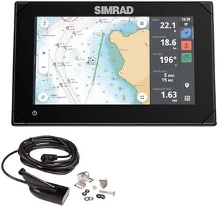
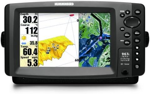
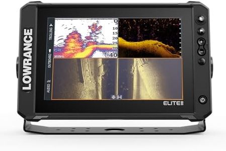
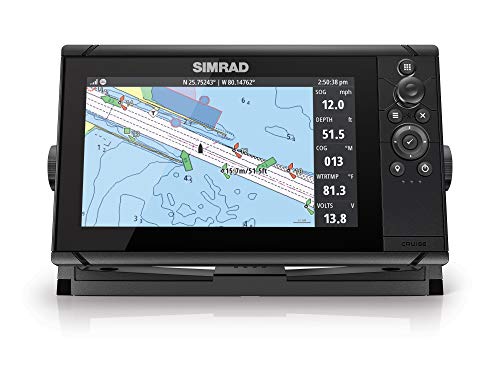
Choosing the right chartplotter is essential for anyone who spends time navigating on the water, whether for fishing, sailing, or cruising. A chartplotter shows your real-time position on a digital map, helping you plan routes and avoid hazards. To find the best fit, think about your typical water activities, the size of your vessel, and how you like to interact with your electronics. Below are the key specs to consider, along with explanations to help guide your decision.Screen SizeScreen size refers to the diagonal measurement of the display on your chartplotter. It is important because a larger screen makes charts, data, and sonar images easier to view and interpret, especially in bright conditions or when you need to monitor multiple things at once. Small screens (under 7 inches) are portable and fit small boats or kayaks perfectly, but might feel cramped. Medium screens (7–9 inches) strike a good balance for most recreational boaters. Large screens (10 inches and above) suit bigger boats with plenty of dash space and are ideal for serious navigation or fishing where you want split-screen features or lots of data at a glance. Think about your boat's layout and how many people need to view the screen at once to decide what's right for you.
Chart CompatibilityChart compatibility determines which types of navigation maps your chartplotter can display. Some devices only support basic included maps, while others allow you to purchase and install advanced charts with more detail, depth contours, and frequent updates. Consider if you need specialized maps for inland lakes, coastal areas, or global travel. For general boating in familiar waters, built-in charts can be sufficient. For exploring new areas or for fishing, look for chartplotters that support premium chart upgrades or allow you to download extra maps. Check that the maps available cover the regions where you plan to boat.
GPS AccuracyGPS accuracy indicates how precisely the chartplotter can pinpoint your position. Higher accuracy means safer navigation, especially in tight waterways or difficult conditions. Entry-level models often offer accuracy within a few meters, which works for casual cruising. Advanced chartplotters feature enhanced GPS modules or can use additional satellite systems (like GLONASS) for even finer precision, useful for navigating tricky passages or when anchoring in crowded areas. If you navigate in complex waters or rely heavily on precise waypoints for fishing, give priority to higher GPS accuracy.
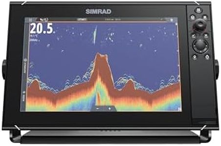
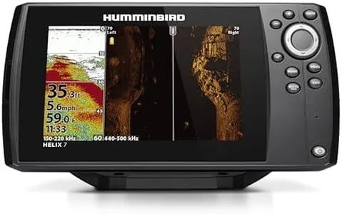
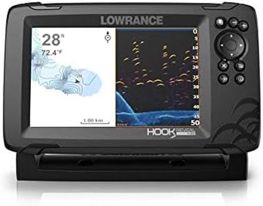
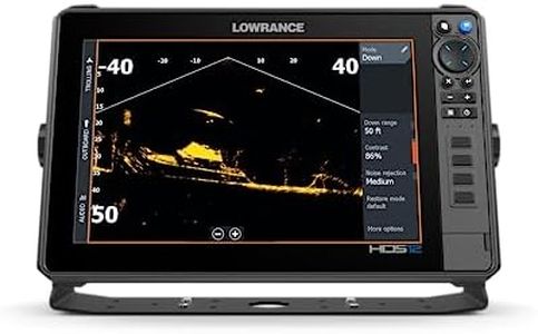
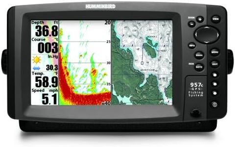
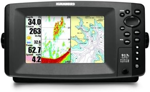
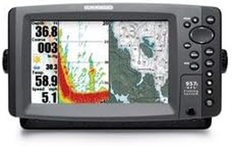
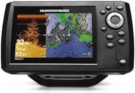
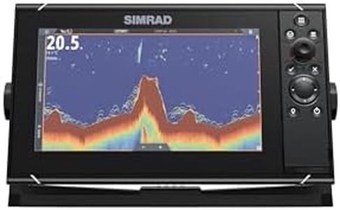
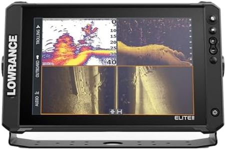
Sonar CapabilitiesMany chartplotters combine sonar (also called fishfinder) features to show what's beneath your boat. The value and type of sonar—such as basic, down imaging, or side imaging—will affect what you see. Basic sonar is good for showing depth and finding fish directly below. Down imaging gives clearer, photo-like images of structures, while side imaging lets you scout a wider area. If you mostly navigate and don’t fish, you might skip advanced sonar. But for anglers or those boating in shallow or unfamiliar waters, having more advanced sonar built in can reveal hazards, drop-offs, or fish hotspots.
Networking and ConnectivityNetworking and connectivity describe how your chartplotter links with other devices—like other chartplotters, radar, sonar transducers, or even smartphones. Basic units are standalone, suitable for small boats or simple needs. Mid- and high-end models can share data and work with autopilots, engine sensors, and other marine electronics, which makes them valuable on larger or well-equipped boats. Evaluate whether you want an all-in-one device or need to connect to other equipment, and check for widespread connection standards like NMEA 2000, WiFi, or Bluetooth.
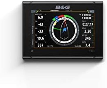
Touchscreen vs. Button InterfaceInterface options affect how you interact with your chartplotter. Touchscreens are intuitive and make map panning, zooming, and setting waypoints faster, much like using a smartphone. Button-only units can be easier to use in wet or rough conditions, where touching a screen might be tricky. Some chartplotters combine both controls. If you often wear gloves or boat in rough seas, buttons may be more reliable, while touchscreens suit calm conditions and users who prefer modern interfaces.
Waterproofing and DurabilityWaterproofing and durability ensure your chartplotter survives exposure to rain, splash, and sun. All marine chartplotters have a waterproof rating, but some are more rugged and suitable for open-air installation. If your chartplotter will be outside and exposed, check for a higher waterproof (IPX) rating and a robust design. For boats with protected consoles, standard waterproofing is typically enough.