We Use CookiesWe use cookies to enhance the security, performance,
functionality and for analytical and promotional activities. By continuing to browse this site you
are agreeing to our privacy policy
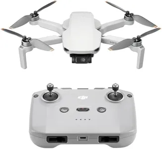
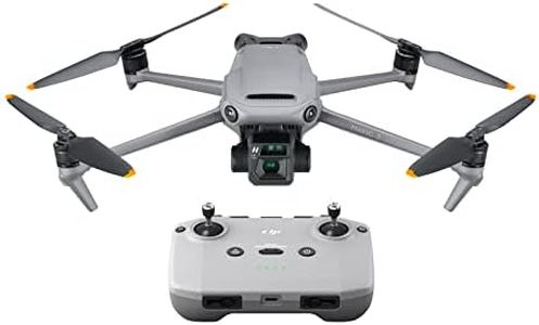
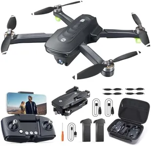
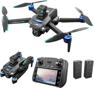
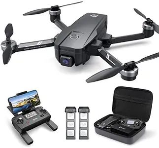
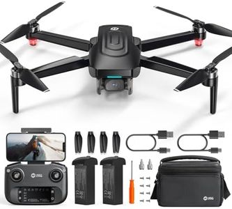
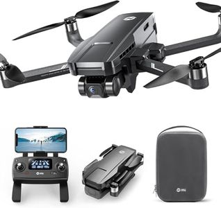
10 Best Photogrammetry Drones
From leading brands and best sellers available on the web.By clicking on a link to a third party's website, log data is shared with that third party.


Related Products
Up to 15% off
Buying Guide for the Best Photogrammetry Drones
Choosing a photogrammetry drone is an exciting step if you want to create accurate 3D maps, models, or perform detailed land surveys. The best fit for you depends on your intended use, whether it’s land surveying, construction, agriculture, or something else. Start by understanding your specific project needs, the area you want to cover, the resolution you desire, and the conditions in which you’ll be flying. The ideal drone will balance flight capability, camera quality, positioning systems, and ease of use. It’s important to focus on the specs that directly affect data accuracy and operational efficiency so your final output meets your expectations.Camera ResolutionCamera resolution tells you how detailed the images from the drone will be, usually measured in megapixels (MP). For photogrammetry, higher resolution is crucial because it allows you to capture fine details, build more accurate models, and ensure that no important features are missed. Simple projects—like mapping a backyard—might be fine with lower resolutions (12–16MP), but for professional surveying, construction, or large-area agriculture, look for cameras with 20MP or more. If you need to detect small objects or create highly detailed 3D models, favor higher megapixels.
GNSS (Global Navigation Satellite System) AccuracyGNSS accuracy means how precisely the drone can determine its position using satellite signals—essential for accurate mapping and reconstruction. Consumer drones rely on basic GPS, which can be accurate to several meters, while advanced models might use RTK (Real-Time Kinematic) or PPK (Post-Processed Kinematic) for centimeter-level precision. Think about your application: for rough overviews or large areas, basic GNSS is acceptable, but for survey-grade results or detailed engineering tasks, RTK or PPK are necessary. Your need for position accuracy will decide how advanced your drone’s GNSS should be.
Flight TimeFlight time is how long the drone can stay airborne on a single charge. Longer flight times (25–40 minutes) mean you can cover larger areas in one go and spend less time swapping batteries, which is particularly important for big projects. For small plots or quick jobs, shorter flight times may be sufficient. Think about how much ground you need to cover per flight and choose a drone that matches your typical mission length—this keeps your workflow efficient and reduces downtime.
Payload CapacityPayload capacity measures how much weight the drone can carry—important if you plan to swap or upgrade cameras and sensors. Some photogrammetry drones only carry built-in cameras, while others allow you to attach specialized sensors, like multispectral or thermal cameras. The more flexible the payload options, the more versatility you have. If your main aim is photogrammetry with a standard camera, high payload isn’t crucial. But if you foresee adding different sensors, prioritize payload capacity.
Stability and Wind ResistanceStability and wind resistance indicate how well your drone can hold position and avoid drifting, especially in breezy conditions. Since photogrammetry depends on capturing stable, sharp images from repeatable positions, a drone that can resist wind (generally up to 20–30 kph) is preferred. For work in open fields or coastal areas, stronger wind resistance is essential. Reflect on the typical weather and terrain you’ll be flying in—if unpredictable or windy, choose drones with higher-rated stability.
Software Compatibility and WorkflowSoftware compatibility refers to how easily your drone and its outputs integrate with mapping and modeling software for photogrammetry. Some drones come bundled with proprietary apps, while others allow exports to third-party programs. For most users, a simple and seamless workflow from mission planning through image processing saves time and avoids technical headaches. If you have preferred software or need compatibility with standard mapping tools, ensure the drone supports those formats and has a user-friendly planning app.